Outlook
Outlook, Saskatchewan, Canada
Incorporated as a Village in 1908
Incorporated as a Town 1909
Located at Township 29, Range 8, W3
Lat- 51º 29' 20“ N,
Long- 107º 3' 10” W
In RM of Rudy
The pictures below were sent to me by Mr. Kenneth J. Friedt.
All 3 were taken in 1912
Ken bought some old negatives, at a garage sale, and after developing, this was a small sample of them.
Sad to say the photographer is not known. All we know is he worked on the Railroad,
and was very likely part of the engineering, surveying team.
Ken sent the negatives to the SK Archives, for safe keeping,
but before he did that, He shared them with me.
Most of his pictures can be seen in my Roche Percee Pages, Ken Friedt, ca:1910 Photos
But now I am finally getting around to making pages, for the few places that were not Roche Percee photos.
Hope you enjoy them.
Normally I thumbnail the pictures, but with only 3, I left them full size.

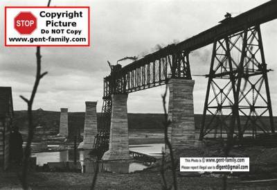
Negative no 67, Nearer View, Outlook Bridge, Apr. 27, 1912
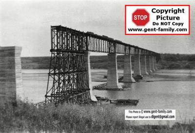
As of 2003, this old CP Railway Bridge, is now called the Skytrail Bridge
Built by the CPR, it served from Oct 23, 1912 until Mar 16, 1987
It was converted to the longest pedestrian bridge in Canada,
and is now part of the Trans-Canada Trail.
the Bridge crosses the South Saskatchewan River.

Negative no 69, Outlook Bridge, Apr.27, 1912

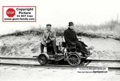
Negative no 68, Motor Car, Mr. Moon & M.E., Outlook, Sask., April 27,1912
No idea who these 2 guys are, do you?
External Links
Note- these are not my sites,
Links may or may not work in the future.
I do not control the content on these pages.
Town of Outlook
http://town.outlook.sk.ca/
